
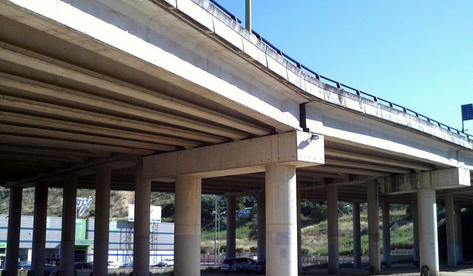

You may be surprised to learn that Madrid’s first ring road wasn’t the M-30. Prior to this, two ring roads had already been built in the city, which, back then, was obviously much smaller than it is today. It was built to alleviate the density of vehicles that travelled through the centre of Madrid.
The construction of Madrid’s first ring road
Madrid’s first ring road was the M-10, also known as Paseo de Ronda. It was built at the same time that the city’s first expansion plan was being rolled out, the Castro Plan, in 1860. You will be interested to know that it was named after Carlos María de Castro, the engineer and town planner who created it.
The M-10 was partially inspired by the old Cerca de Felipe IV. Broadly speaking, it encompassed what is now considered Madrid’s historical centre or Central District, with an area of 5.23 square kilometres.
It had three main points: the Prado-Recoletos axis, the Boulevards and the Rondas. To give you a clearer idea about it we’ll explain what its sections were.
The main ones were those that went from Paseo del Pintor Rosales to Calle de la Princesa, the one that ran from the latter to la Glorieta de Ruiz Jiménez and which included la Glorieta de Bilbao, the squares of Alonso Martínez, Colón, Cibeles and Emperador Carlos V, the Ronda de Valencia, the Embajadores and Puerta de Toledo roundabouts as well as calle Segovia.
Currently, Madrid City Council is planning to create an M-10 for cyclists, in other words, with a lane in each direction for bikes that will run along the original ring road. The maximum speed permitted will be 30 km/hour.
However, as stated at the beginning, before the M-30 there were two ring roads. One was the one we have just mentioned. And the second was an evolution of the first, which became known as the M-20.
Evolution of Madrid’s first ring road
Madrid’s second ring road, an evolution of the first, added to the former; the streets Francisco Silvela, Pedro Bosh, Joaquin Costa, Doctor Esquerdo, Raimundo Fernandez Villaverde, San Francisco de Sales and General Ibáñez de Íbero, as well as la Reina Victoria and Planetario avenues. Nevertheless, it was soon noted that this ring road was becoming too small. As a result of this, planning of the M-30 got underway.
Madrid’s third ring road came about as part of Plan Bidagor. In other words, The General Plan for Urban Zoning, drawn up in 1946 by the town planner, Pedro Bidagor Lasarte.
He, in turn, used previous projects from the Civil War as a reference which outlined the construction of two ring roads outside the city, specifically in the Plan Zuazo-Jansen from 1929. The first of those was what is known as the M-30 today.
It is 32.5 kms long and has a radius of approximately five kilometres, taking la Puerta del Sol as its centre. Construction started in 1970, although it wasn’t completely finished until 20 years later.
However, this ring road has been practically in full use since 1974, which provided great relief to the city’s road traffic.
Its sections are those which go from Manoteras junction to Avenida de América, which runs through Plaza Conde de Casal and, then, the junctions of Nudo Sur, Avenida de Portugal, Puerta de Hierro, La Zarzuela, Avenida de la Ilustración, la Paz and Norte junctions, ending up again at Manoteras junction.
In conclusion, we could say that Madrid has been provided with external ring roads in line with the growth of its perimeter. From the original M-10 from the nineteenth century, to the M-20 and the M-30.
Related reading
Photo: CarlosVdeHabsburgo, CC BY-SA 4.0, via Wikimedia Commons

[…] M-30 is a benchmark for mobility in the Spanish capital. It is a ring road around the city with the characteristics of a motorway. Except in the north section of Avenida de […]